Tag Archives: London streets

Top or bottom

Following on from last week’s post, discussing the highs and lows, and giving you an insight to my shortest and longest (journeys that is), we now come to this tricky question: Is a destination at the top or bottom of a street?

If a street actually does, you know, climb a hill then the top is just naturally the top.

Or does top or bottom refer to the street’s numbering?

The British Postal Museum and Archive claim the first recorded instance of a street being numbered is Prescot Street in Goodmans Fields around 1708. Regulation did not take place until 1855 with the passing of the Metropolitan Management Act, by that time there were different numbering systems even in the same street, for example in 1780 Craven Street near Strand had three sets of numbers.

But where does the numbering start?

Odd numbers are usually assigned to the left side of the street and even numbers to the right side, commencing heading out of the town centre from the town hall or other civic building, or even numbers can be placed on the north and west sides and odd numbers on the south and east sides of streets. I hope that clears up some of the confusion.

I was once asked by a customer to go to an annexe of the Chinese Embassy in Portland Place. I asked, quite reasonably I thought, as the road is a dual carriageway, which side of the street is number 66. Her reply the north side, oh dear, the road runs north to south. Now armed with this new information makes the Chinese annexe on the same side as the embassy – possibly.

When asked to go to a destination your passenger expects, quite rightly, to be taken via the shortest route. But when someone does say “I’m at the top of the road”, what do you think they mean?

Portobello Road, with its two postcodes of W10 and W11, is mainly one way (sometimes in different directions) for its entire length of over a mile and travels in an S(E) to N(W) direction, I would think that it’s a no brainer that the Notting Hill end was the bottom, wouldn’t you? After all, that end is its most southern extremity, but, spoiler alert, Notting Hill is on a hill, thus making it the top end. But wait it also starts to rise at its westerly end and is 6ft. higher than Notting Hill.

According to the previously described numbering regulations surely its numbering should start in Notting Hill (nearest to central London), but its located in the Royal Borough of Kensington and Chelsea whose town hall is directly south of Portobello Road.

Some of you might think this slight nit-picking, or perhaps slightly obsessional, but when your job is to get people as efficiently as possible to their destination, these things really are important.

Incidentally, the numbering of Portobello Road starts at the eastern end at Notting Hill with the odds on the left.

So it would appear, the top of the road has the bottom numbers, with the odds on the left. There I’m glad I’ve cleared that up.

Monopoly Madness

Eighty-five years ago saw the arrival of the first Monopoly game and looking at my pre-war version it would appear that when the selection of properties to include they made, some rather curious choices were decided upon.
The game didn’t reach the shops until 1936, Victor Watson upon seeing his first version on a Friday in December 1935, didn’t waste any time. Prompted by his son he made a trans-Atlantic call (rare at the time) and had signed a deal with Parker Brothers in America to license the game by the end of the weekend.
Over 20 million sets have been sold in Britain. Silk maps were hidden inside Monopoly boards and sent to Allied prisoners, inspiring Get Out Of Jail Free jokes; and once the Great Train Robbers played Monopoly with real stolen notes while holed up in a Buckingham farmhouse.
But back to the rather idiosyncratic choices for my original board.
Why is there an American car with whitewall tyres on Free Parking or a New York policeman instructing me to Go To Jail? And why is Piccadilly’s rent on a par with the cheaper yellows, when it should have been £2 more?
The tokens are, at best, random. A car and top hat for toffs; a rocking horse for children; and I suppose the iron, thimble and shoe were what 1930s women wanted) they did at least introduce a purse later to give women more independence). But where did the battleship and cannon come from just months before World War II?
Back to the 1936 board’s eclectic property portfolio chosen by Victor Watson and his secretary Marjory Phillips on a tour of London in a black cab. Was the cabbie reluctant to go ‘Sarf Of The River’ hence only Old Kent Road on the board is south London’s only property?
Ask a cabbie today for Vine Street and he would have a job locating a dead-end alley 70ft long behind Piccadilly. I was asked Coventry Street on my first Appearance for The Knowledge, most Londoners wouldn’t know it runs from Piccadilly Circus to Leicester Square and just a few hundred yards long. I didn’t know it at the time of asking.
The Angel, Islington purportedly was where Vic and Marg stopped for a cuppa at a Lyons Corner House tea room (did the cabbie join them?), but why was it included? Surely Pentonville Road, which runs into the Angel was a better choice, whilst following the board’s format of ‘roads’ and ‘streets’, except for Leicester Square.
Marlborough Street as far as know doesn’t exist now or then unless you include some rather upmarket council flats on the Sutton Estate in Chelsea. It’s GREAT Marlborough Street that the Marlbro cigarettes were named after as the company had their London office there.
Bond Street sounds rather posh but has niggled Monopoly purists for almost a century. Looking at my Geographers’ A-Z, three exist, one is 100 yards long adjoining Chiswick High Road, another in Ealing is equally as short, with a third a stone’s – or javelin’s – throw from the Olympic Park.
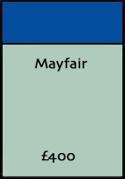
Unlike its companion, Knightsbridge which is an actual street (but not with Harrods on it), Mayfair is an area mostly owned by the Duke of Westminster. In the late 1950s, the Duke of Westminster agreed to allow the United States to demolish the whole of the west side of Grosvenor Square so they could put up the terrible building we see today. But the siting of the American Embassy led to one of the most bizarre and protracted processes of negotiation ever seen in London.
The Americans have embassies all over the world and in every single case, they buy the land first and then build their embassy. They assumed that this would be possible in England so they asked the Duke of Westminster, who owned Grosvenor Square, how much they would have to pay to buy the freehold of the land. What they didn’t know is that the Grosvenor family never sell. Their vast wealth is based precisely on this simple fact: they own three hundred acres of central London including most of Belgravia and Mayfair, not to mention land holdings all over the world. All the houses and offices on this land are leased; their freeholds are never sold.
When the Americans were told they couldn’t buy their land they insisted that was unacceptable and that they would petition Parliament to force the Duke to sell. Questions were asked in Parliament; the Grosvenor family were heavily leaned on but all to no avail.
Then the Duke thought of a good compromise. He told the furious Americans that if they were prepared to return to the Grosvenor family all those lands in the United States stolen after the American War of Independence then he would allow the Americans to buy their site on the west side of Grosvenor Square. The Americans knew when they were beaten (they would have had to give the Duke most of Maine and New York) and unwilling to hand over the land they had stolen from the Indians anyway, they backed down and the Duke of Westminster allowed them a 999-year lease. And that explains why the embassy in London was the only American embassy built on land not owned by America. Presumably, they own their sparkling new gaff in Nine Elms Lane.
Culling Greater London’s 45,687 streets into twenty-two during a weekend was always going to be challenging, in the 1920s London was the largest city the world had ever known and by 1935 it peaked at 9 million, so I suppose we will have the leave the London board as it has always been, or buy one of the many new permutations.

Capital Letters

Looking at the index of my Collins Superscale London maps I noticed that each section commenced with a capital letter. As I worked my way through the list I found, incredibly, four streets in London appear to have unique names. So, without further ado, here is the first street in every letter in London.

AAaron Hill Road (E6) 400 years ago Aaron Hill was a poet and dramatist, renowned in London for his adaptations of Voltaire, and successful enough to be buried in Westminster Abbey.

BBabmaes Street (SW1) Founded in 1872 the Naval and Military Club, known as the In and Out Club has its premises in the house once owned by Britain’s first female MP – Nancy Astor. The club’s old location in Piccadilly had an in and out drive, hence its nickname. Now its doors are located in St. James’s Square and 7-9 Babmaes Street. In and Out indeed.

CCabbell Street (NW1) Jack ‘Spot’ Comer was an East End gangster attacked outside his home in Hyde Park Mansions on Cabbell Street in 1956. Son of Polish immigrant parents and born into grinding poverty in Whitechapel, Jack Spot joined his first gang at an early age. Comer rose to rule the criminal underground via protection and gambling rackets, by the late 1940s he was making a fortune at the racetrack working in partnership with another famous gangster, Billy Hill.

DDabin Crescent (SE10) Dabin Crescent is only 157 yards long. There is only one street named Dabin Crescent making it unique in Britain.

EEagle Close (SE16) This cul-de-sac of only a few yards long is but a stone’s throw of the last entry here, Zampa Road.

FFabian Street (E6) This short close with only a couple of dozen houses has the advantage of a footpath at the end giving access to the Greenway, a 4.3 mile-long footpath and cycle highway mostly in Newham which at its easterly end runs along the embankment containing the Joseph Bazalgette Northern Outfall Sewer.

GGables Close (SE5) Not many gabled properties here about, the flats do provide easy access to the Camberwell College of Arts counting actor Tim Roth, musician Humphrey Lyttelton and designer Laurence Llewelyn-Bowen amongst its alumni.

HHaarlem Road (W14) This short street at 94 yards long can boast that it is one of only 3 similarly named Haarlem Roads in Great Britain.

IIbbotson Avenue (E16) There is only one street named Ibbotson Avenue making it unique in Great Britain.

JJacaranda Grove (E8) Properties here, despite the large number of council flats nearby, sell for more than £1 million. At least the local female MP lives in the adjacent road.

KKassala Road (E13) Approximately 120 yards long, this is the only street named Kassala Road making it unique in Great Britain.

LLaburnum Close (SE15) Unsurprisingly there are 84 other streets named Laburnum Close in Great Britain.

MMabledon Place (WC1) UNISON union once had their headquarters at the junction of Mabledon Place and Euston Road.

NNag’s Head Court (EC1)
There are a plethora of Nag’s Heads in London, but it’s hard to imagine a boozer being squeezed into this minute street near the Barbican.

OOak Crescent (E16) Although you have to pay over £350,000 for a flat here the street is yards from the Canning Town Flyover.

PPace place (E1) Could this be the shortest street on this list? So small the postcode E1 2NA was terminated by the Royal Mail in December 2016.

QQueen Elizabeth Street (SE1) The expensive apartments a short walk from Tower Bridge has outside Jacob a life-sized statue of a dray horse as its centrepiece for The Circle to commemorate the history of the site. He was flown over London by helicopter into Queen Elizabeth Street to launch The Circle in October 1987.

RRabbit Row (W8) Rabbit Row is a mews predominantly one-sided, with only 4 properties. The original purpose of the Mews was to provide stable/coach house accommodation for the larger houses on Kensington Mall.

SSabbarton Street (E16) It’s a pity this very short street off Silvertown Way is industrialised, as at its end is a view of Bow Creek as it flows into the Thames.

TTabard Street (SE1) Part of the one-way system at the Borough, I can only think it takes its name from the Tabbard Inn once famous for accommodating people who made the pilgrimage to the Shrine of Thomas Becket in Canterbury Cathedral

UUamvar Street (E14) The entomology of this strange name could be derived from Uaighmor, also anglicised Uam Var, the name means ‘Great Cave’, referring to a large cave in the cliff face which was a hideout for brigands into the eighteenth century.

VVale, The (SW3) Just how many Vales are there? This one-off the King’s Road is the cabbies’ cut-through to Elm Park. A turning off The Vale is Mulberry Walk once home to Mark Knopfler of Dire Straits and actor Laurence Olivier.

WWadding Street (SE17)
Close by was the Heygate Estate, a massive concrete warren containing 1,100 homes. Quite why post-war architects thought such grimly functional structures embodied the progressive, honest and classless fresh start we needed after the war.

XNone now There used to be an XX Place, off Globe Road E1, it was a narrow street, first on the left off Globe Road from Mile End Road, serving ten small cottages on the north side.

YYabsley Street (E14) There is only one street named Yabsley Street making it unique in Great Britain.

ZZamba Road (SE16) The most famous road of this list as at the end of its 200 yards is The Den, Millwall Football Club.

Do Not Pass Go

I’m reading Tom Moore’s Do Not Pass Go a travelogue of one man’s erratic progress around those 28 London streets, stations and utilities that comprise the iconic Monopoly board. So I thought this was an opportune time to re-publish a Cabbie’s London Monopoly Board, but first a little bit about where it all began.

It was a tough job, but somebody had to do it.

When Waddington’s bought the rights to Monopoly from American games manufacturer Parker Brothers in 1935 the positions on the English version of the iconic board had to be assigned. London was the choice of location and so somebody was tasked to seek out the appropriate ‘Properties’.

Added to that there was some small degree of rivalry, for Parker Brothers who intended to use Atlantic City on their version hadn’t as yet brought what was to become an iconic board game to market.

The onerous job of travelling by cab seeking out the board’s positions fell to Waddington’s managing director, Victor Hugo Watson.

Although born in Kennington Oval in 1878 Watson had been brought up in Yorkshire, joining Waddington’s in 1908, and now 27 years later he was persuaded by his young son to buy the rights for an English version of Monopoly, responsible for bringing the game to market.

He was joined by his secretary Marjorie Phillips, and after a morning taxi ride gathering possible positions for including for their board game stopped off for tea at The Angel Corner House Tea Rooms.

There had been an Angel coaching inn here since the 17th century and the current building in pale terracotta stone had been completed in 1899. The pub ceased trading in 1921 and sold to J. Lyons & Co. to be refitted to join the growing numbers of Lyons Corner Houses.

Probably losing interest in their assignment and having Pentonville Road already on their list, the Angel, itself on Pentonville Road seemed to be an afterthought as it is the only position, not an actual street, well, Mayfair does have – Place and Mews.

There is now a plaque on the old Angel building – which is now the Cooperative Bank – which was unveiled in October 2003 by Victor Watson’s grandson also called Victor marking the spot of that famous tea break.

The Old Kent Road is the only property on the original board south of the River. Could it be that even in 1935 cabbies were reluctant to go ‘South of the River’? Why was there an American car with whitewall tyres on Free Parking and a New York cop on Go to Jail? And as Tom Moore points out, did anyone ever bother with mortgage interest?

While rummaging through my attic by chance I came upon an old pre-war Monopoly set once owned by my parents, it wasn’t one sent to Allied prisoners, with silk maps hidden inside, prompting Get Out of Jail Free jokes among the troops. Nor was it the set used by the Great Train Robbers, who actually used real money when hiding out.

Monopoly is a redesign of an earlier game “The Landlord’s Game”, first published by the Quaker and political activist Elizabeth Magie. The purpose of that game was to teach people how monopolies end up bankrupting the many and giving extraordinary wealth to one or a few individuals; it seems rather prophetic for the world we live in nowadays.

Since the game was created in 1936, more than one billion people have played it; making it the most played board game in the world. The mascot for the game, known as Mr Monopoly or Rich Uncle Pennybags, is an elderly moustached man in morning dress with a walking cane and top hat. Here, wearing a flat hat and muffler is a London cabbie’s version on the board game.


VINE STREET
The most obscure location on the Monopoly board, in essence, a yard branching off Swallow Street, a cul-de-sac approached from the eastern end of Piccadilly.

Taking its name from a public house that stood there, the street was originally longer and is best known for the police station that once was there. It was to Vine Street nick, said to have been the busiest in the world that the Marquess of Queensbury was taken in March 1895 to be charged with criminal libel against Oscar Wilde, thus setting in train a series of events that eventually led to Wilde’s imprisonment.


EUSTON ROAD
Like London itself, the cab trade is full of interesting stories, myths and general nonsense. But one of my favourite cabbies things is trying to “ride the green wave” from King’s Cross to the Marylebone flyover.

This is when you drive that whole stretch without hitting one red light along the way. No-one is actually sure if it’s been done or not but there are plenty of, probably apocryphal, stories of cab drivers carrying on journeys all the way to the Marylebone Flyover to complete the Green Wave, despite their punters only wanting to go to Baker Street.


PENTONVILLE ROAD
A straight stretch of road rising up an incline once known as Islington Hill; travelling up this hill students of The Knowledge get an inkling of what a condemned man feels to ascend the steps of the gallows. For at the crest of the hill is Penton Street in that once was situated the Public Carriage Office, where those who sought to obtain a taxi licence would get a grilling from the examiner who had an interrogating technique worthy of the CIA.

Pentonville Prison nearby has been called “the most copied prison in the world”, much like The Knowledge.


OXFORD STREET
The most pointless street in London; with its 18-hour traffic jam of mostly empty buses stretching along its entire length of 1.5 miles. Weaving between the buses can be found shoppers, so intent on the business of running from shop to shop while talking on their mobile phones they are culled on a regular basis when failing to notice a red vehicle the size of a small house approaching.

Once known as Tyburn Road the thoroughfare formed the route for the condemned from Newgate to the hanging gibbet at modern-day Marble Arch.

You can tell that Monopoly was devised in a more relaxed and gentler age. We find a square entitled ‘Free Parking’; for in the 21st-century free parking for cabs lasts just two minutes and one second before Westminster Council issue a ticket.

My pre-war Monopoly set has tokens comprising a thimble, hot hat and a flat iron more reminders of a bygone age; while the next four locations have changed beyond all recognition over the last 75 years.

OLD KENT ROAD
When designing the London Monopoly Board in 1936 they didn’t want to go Sarf of the River; a bit like cabbies are accused of saying these days. For the Old Kent Road is the only square on the Monopoly Board from our southern environs, and one of the cheapest. Gentrified nowadays in Southwark and Bermondsey, Old Kent Road remains stubbornly working class.

The route taken by Chaucer’s pilgrims on their journey to Canterbury, there aren’t even any decent watering holes left. The Dun Cow is now a surgery and The Thomas à Becket has become a furniture shop.

THE ANGEL, ISLINGTON
Taking its name from a coaching inn that had stood on the site from at least 1638; I have often wondered what attracts the tree-hugging, muesli munching, Guardian readers to this predominantly poor area.

So polarised is it that council tenants live cheek-by-jowl next to £¾ million terraced houses. I then learnt that the republican Thomas Paine, inspired by the French Revolution probably wrote the first part of his The Rights of Man while staying at the pub that gave its name to the area, the Angel in 1790, could the rich be trying to emulate him?

COVENTRY STREET
My first question on The Knowledge: Prince of Wales Theatre to Prince of Wales Drive? – Leave on right Coventry Street; right Whitcombe Street; right Panton Street; left Haymarket; right Pall Mall; left Marlborough Gate; forward Marlborough Road; right The Mall; left Spur Road; right Birdcage Walk; forward Buckingham Gate; forward Buckingham Palace Road; forward Ebury Bridge Road; left Chelsea Bridge Road; forward Chelsea Bridge; forward Queenstown Road; comply Queen’s Circus; Prince of Wales Drive on left – easy!

I sat there paralysed like a rabbit caught in headlights.

MARLBOROUGH STREET
Correctly entitled Great Marlborough Street and named in honour of John Churchill, 1st Duke of Marlborough. It is probably the slowest road in London for the pedestrian crossing outside Liberty’s is in constant use, still, it gives you the time to look at the famous store with its façade constructed from the timbers of the Navy’s last two wooden warships, HMS Impregnable and HMS Hindustan. As a footnote Marlboro cigarettes take their name from the street which in the late 19th century the Philip Morris Company’s factory was situated.

Take the punishment meted out to banker Henry Fauntleroy. Having been found guilty of defrauding the Bank of England of £250,000 (today’s Masters of the Universe wouldn’t get out of bed for that trifling amount), his public hanging on 30th November 1824 outside Newgate prison attracted 100,000 people, the largest ever crowd to watch a public execution. Unpopular, not for being a banker, but for squandering the money that he managed to steal from the English people.

FLEET STREET
Taking its name from the river nearby, the Fleet Prison was one of the most feared penal centres in London.

The prison provided the starting point for public whipping where offenders were forced to walk the length of Fleet Street to Temple Bar attended by a constable charged with whipping sufficiently hard ‘to make the back bloody’, when the punishment was over the victim could look up at Temple Bar which provided a convenient place to display the bloody decapitated heads of traitors. To stop the head being picked clean by birds it would be boiled in brine and cumin seed.

BOW STREET
Originally built in the shape of a bow it was once an elegant street that later became notorious for its brothels; it was also the site of Will’s Coffee House, a forerunner of Starbucks, where the famous would sit around talking nonsense all day. Home to Bow Street Magistrate’s Court until 2006, Henry Fielding started the Bow Street Runners here in the 18th century and his half brother John was a magistrate who pursued crime “with vigour and success”.

Although blind John Fielding was given the improbable credit of being able to recognise 3,000 thieves by their voices.

PARK LANE
As its name alludes to, Park Lane was once just a lane alongside Hyde Park, now a six-lane dual carriageway terminating at its northern extremity with Marble Arch. Once the site of Tyburn, the gallows there would, for the economy of scale accommodate 21 men and women at a time. Convention dictated the order of precedence, highwaymen as the ‘aristocrats of crime’ were dispatched first presumably to ensure a higher number of spectators would attend before they became bored with the entertainment, next would come, common thieves, with traitors being left to bring up the rear.

WHITEHALL
Halfway down Whitehall lays Banqueting House the only remaining part of the old Whitehall Palace. It has a gallery where the King’s subjects could watch him dine. The ceiling by Rubens celebrates the benefits of the wise rule, the irony of which is not lost on historians as the painted ceiling was one of the last things King Charles I would see before being beheaded for not listening to his people. His neck vertebrae were only recovered hundreds of years later when a horrified Queen Victoria discovered that her surgeon Sir Henry Halford was using it as a salt cellar for his fish and chips.

This time it’s all about money ‘Pass Go and Collect £200’, £200 doesn’t seem much today but remember you can buy Mayfair from the Duke of Westminster for only £400, what a bargain. Assuming you have collected your £200 where do you go to spend your gain, the shops of course.

REGENT STREET
Forget Oxford Street, Regent Street is by far a more elegant place to shop. Designed by John Nash, the original construction with its elegant curves had a covered colonnade for pedestrians to walk under to protect them from the elements as they moved from shop to shop.

It proved rather popular for prostitutes to use as a cat-walk while displaying their wares so it was demolished by 1920. The shop fronts now just look like any other row of shops. Hamleys would look rather interesting for the children with the “ladies” parading outside.

BOND STREET
Yes, you are right Bond Street doesn’t exist. Old Bond Street is only 14 years older than its newer sibling, imaginatively named New Bond Street, both acquired the aristocratic seal of approval when the Duchess of Devonshire in 1784, after a fit of pique, organised a boycott against the hitherto smarter shops of Covent Garden.

Modern Bond Streets are packed with designer label flagship stores and jewellers which have become a favourite with smash and grab thieves on motorbikes. Separating the two streets is pedestrianised and has a sculpture depicting Churchill and Roosevelt seated on a bench.

PICCADILLY
Named after the curious ruff much favoured by Elizabethans, the starched collar was called a piccadill. J. C. Cording, the suppliers of tweed and cords to the huntin’, fishin’ and shootin’ set is part-owned by “Slowhand” himself Eric Clapton. Waterstones opposite was once Simpsons of Piccadilly department store and Jeremy Lloyd, having worked as a shop assistant there based his 1970 comedy Are You Being Served on his experience. While Fortnum & Mason was started by William Fortnum Queen Anne’s footman who saved his pennies to start the store by selling cut-price candles to the palace.

MAYFAIR
The Americans wanted to buy the freehold to build their embassy, in Grosvenor Square in the heart of Mayfair, but the Grosvenor family never sell, all are leased. When told they couldn’t buy the land they insisted and petitioned Parliament; the Grosvenor family were heavily leaned on but all to no avail. Then the Duke thought of a good compromise. He told them that if they were to return to the Grosvenor family all those lands in the United States stolen after the American War of Independence including Maine and New York he would allow them to buy their site on the west side of Grosvenor Square, they backed down.

Now we have visited most streets and squares on my Cabbies’ Monopoly board, it’s time now to build a house. The houses in the true 1930s Monopoly fashion should be semi-detached with bay windows with the ubiquitous privet hedge marking their road boundary, the houses here are just a little grander than your average semi.

NORTHUMBERLAND AVENUE
Northumberland House, the London home of the Percy family; the Dukes of Northumberland demolished in 1874. Standing just south from Trafalgar Square it was the last of the great Strand mansions to succumb. His grace did have another house to fall back on though; Syon House in Isleworth and it was to this estate the giant emblematic Percy Lion – which had stood guard over the main gateway facing the Strand to Northumberland House for over 150 years – was taken. In the 17th century the house formed part of the dowry when the Earl of Suffolk’s daughter married Lord Percy.

LEICESTER SQUARE
Once one of the biggest houses in London once stood on his large square. Celebrated for its rather dangerous entertainments in 1672 John Evelyn dined here and was beguiled by Richardson “the famous fire-eater, who before us devour’d Brimston on glowing coales, chewing and swallowing hem downe”.

Life here was even more dangerous 100 years later when the father of the future “Mad” King George III when still the Prince of Wales died after being hit in the throat with a cricket ball. And here’s one for the pub quiz: In 1780 the Toxophilite Society was inaugurated here.

TRAFALGAR SQUARE
The site of the King’s Mews, a vast building in which the Royal Hawks were kept, falconers lodged and daily services held in the “Chapel of the Muwes”. Geoffrey Chaucer once toiled there as a clerk of works. After a fire, the mews were rebuilt as stabling during the reign of Elizabeth I. During the civil war the mews became barracks for the Parliamentary Army and after the Battle of Naseby about 4,500 Cavalier prisoners were incarcerated there. In its last years, the main building was used as a menagerie and a store for public records, demolished in 1830.

WHITECHAPEL ROAD
Henry Wainwright was in the brush making business – one of his biggest contracts happened to be with the Metropolitan police – and his factory stood at 84 Whitechapel Road. He frequented Broxbourne pleasure gardens by the River Lea and it was here in 1871 that he met and later murdered Harriet Lane, he then stuffed the body beneath the floorboards of his factory warehouse.

Henry’s finances later spiralled, forcing him to sell the warehouse the following year. This meant having to dispose of Harriet’s rotting corpse which, exactly a year to the day of the murder, he dragged up and cut into pieces. Henry then wrapped the remains in parcels and asked an unwitting acquaintance named Alfred Stokes to help him carry them. The pair lugged their grim cargo along Whitechapel Road and paused by Adler Street whilst Henry went to find a cab.

By now Alfred was suspicious of the foul-smelling bundles and decided to have a peek. He was horrified to discover a hand and an arm but before he could do anything, Henry returned with a four-wheel ‘growler’; a style of cab which, at the time, was generally considered to be slower and shoddier than the more agile Hansom cabs.

At which point Alfred made his excuses and left. Henry meanwhile told the cabbie to “Drive as fast as you can to the Borough.” Alfred now gave chase, following the cab as it trotted through Aldgate, Leadenhall Street and over London Bridge before arriving at the Hop Exchange. On the way, Alfred begged a policeman to stop the cab but was dismissed as a madman. Luckily he found another bobby patrolling St Thomas Street – Constable Turner- who believed him and arrested Henry Wainwright.

STRAND
Captain John Baily, a veteran of one of Sir Walter Raleigh’s expeditions operated the first a designated waiting place or rank for cabs. From 1634, he managed a rank of four horse-drawn carriages, available for hire from the Strand. Baily’s cabmen wore a distinctive livery and charged customers a fixed tariff depending on distance. The rank was positioned close to the Strand maypole, a prominent medieval landmark. This towered 100ft high, making it one of the tallest structures in London at the time. It must have made the cab rank very easy to find.

PALL MALL
Named after a popular game in the 17th century, Pall Mall was the first street in England to be lit by gas by the splendidly named New Patriotic Imperial and National Light and Gas Company.

Extreme London

Have you ever thought about where some London’s extremities are? Not the edge of its geographical area, but it’s myriad of roads and streets.

London’s shortest thoroughfare


This has to be Leigh Hunt Street, SE1 at 36ft, just a street sign remains, as the street was cut short by the creation of a park. But I go for Kirk Street, WC1 at 50ft as London’s shortest ‘street’ with an address, even if it’s only for the Dickens public house.

London’s longest street

At 1.5 miles is Rotherhithe Street, but Green Lanes at 7.45 miles from Newington Green to Ridge Avenue, Winchmore Hill, is the longest named thoroughfare.

London’s highest road


Westerham Heights, part of Betsom’s Hill adjacent to the A233, at 804ft and where the county boundary intersects just comes within the M25. On the north-west side of the hill, the borders of Surrey, Kent and Greater London meet at Rag Hill.

London’s lowest road


Crossness Nature Reserve, near Thamesmead, a signpost on the Thames Path, where a path leads off into Crossness Nature Reserve by Malc McDonald (CC BY-SA 2.0)
Strictly speaking, the Thames is the lowest point in London, and therefore any adjacent road should qualify, like Lower Thames Street. But it is actually Eastern Way, the A2016 beside the Crossness Nature Reserve, an oasis of wildlife that once was an industrial spot by the River Thames, and is 10ft below sea level.

London’s steepest road


Downe Road Cudham Lane, Bromley, specifically from the road junction nearest the parish church. It drops sharply to a second junction (with Church Hill) before bending left and heading down the steepest hill in London.
Closely followed by the 1 in 5 gradients at Fox Hill, Crystal Palace, this one’s not on the Ordnance Survey map because the road is too minor, but Fox Hill is definitely steep because a sign at the bottom says so. It’s also a historic track and was immortalised in oils in 1870 by the French impressionist Camille Pissarro, who was living in Norwood at the time.

London’s narrowest street


At 15in, Brydges Place is certainly London’s tightest alleyway, funnelling you between St Martin’s Lane (next to the London Coliseum) and Bedfordbury.

London’s widest street


Discounting the M25, laid out in the 1770s by the Adam Brothers and incorporated by Nash in his grand Regency scheme Portland Place was once London’s widest street.

London’s widest pavements


Whitechapel High Street is one of the shortest high streets in London, developed during the sixteenth century as part of the main route between London and Essex, it has the widest pavements in London.

London’s straitest road

We all know that the Romans like to construct their roads in straight lines, regardless of the terrain. So my guess that London’s straitest is Ermine Street – today’s A10 – its southern end is at London Bridge and it ends up in the Norfolk port town of King’s Lynn. While within the M25, it follows an almost vertical line through the City, Stoke Newington, Tottenham and northwards.

Featured image: Welcome to Harringay Green Lanes, the railway bridge carries the passenger service between Gospel Oak and Barking, now part of the London Overground network. Harringay Green Lanes station – called Harringay Stadium until the early 1990s – is just to the right of the bridge, by Stephen McKay (CC BY-SA 2.0)