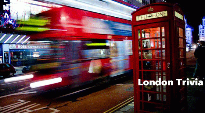
Fat Flying Friends?

Using my ATM has of late been a hazardous experience, not from any street crime, but a far more dangerous assailant coming from the sky. Our local bank has erected a rather splendid sign above its frontage which has proved a perfect perch for pigeons, dozens of them. While ex-mayor Ken Livingstone most positive contribution to London has been to reduce the pigeons of Trafalgar Square from 4,000 to a mere 120, they have like other vagrants just moved elsewhere.

[M]ayor Ken first banned the sale of pigeon feed in 2001 resulting in a family business that had traded for decades having to shut shop. Next at a cost of £60,000 a year he introduced a pair of Harris hawks, with their handler, the expense has almost certainly been covered by the reduction in the cost of cleaning up pigeon droppings from the surrounding areas. Unfortunately the rest of London is still plagued by these feral creatures that carry (sorry about this!) histoplasmosis, cryptococosis and psittacosis, so it would seem the pigeons above my ATM could previously have been a tourist “attraction” from Trafalgar Square.

On my garden on the bird table are regularly two ring necked doves, slim beautiful creatures, even if they are a little stupid and the contrast between our doves and London feral pigeons could be not starker.

Now with our fast-food litter lout culture it has given us pigeons so fat that they can hardly fly out of the way of my cab, with many of them having trouble taking off as they are missing a toe or foot after standing in the piles of their own corrosive droppings. These urban birds are even more stupid than their rural cousins, after centuries of evolution, not one of them have realised that by placing their foot even if it is now a stub, on a piece of bread, they wouldn’t have to throw it over their heads, tearing a piece off in the process.

The numbers of our wild friends, along with foxed and rats needs to be reduced, reports recently have included, dive bombing seagulls, foxes biting children in their beds and if it is to be believed rats 30 inches long.

Sparrow hawks regularly kill pigeons in my garden while the other birds are clever enough to get out of the hawks way it’s only the pigeons that get caught, they could be used to keep the numbers in London down, feeding them something to reduce their sex drive might deprive Londoner’s the opportunity of the amusing spectacle of the males courting rituals, but could have the desired effect.

Writing in the Evening Standard Sebastian Shakespeare suggests a course of action which might prove rather startling to tourists, as the bird’s fall of their perch (or their hands) and I quote:

A more pragmatic way might be to hand out poisoned bird feed to tourists and actively encourage them to feed the pigeons. This would kill two birds with one stone, so to speak: the tourists would still get their photo opportunities and it would be a very cost-effective way of keeping the pigeon population down.

If you still have the need for more about pigeons, I would direct you to Pigeon Blog probably the largest site you find on everything that’s amusing about our fat flying friends.

Eating humble pie

[I]t is now two months since it started, and although it sticks in the craw to say it: I think Bicycle Clips Boris may have picked a winner with his cycle hire scheme.

After some initial technology problems, the bikes are popular and, are usually ridden carefully, probably their weight precluding any Lycra loutish behaviour.

I’m quite happy to see more cyclists take to London’s roads, but I have grave reservation about the two new Super Highways (with a further 10 planned by 2015). These are just strips of blue paint on the tarmac, but they give the impression that cyclists have a divine right to their exclusive use.

TfL’s website informs us that ‘they will provide cyclists with SAFER and FASTER journeys’. Just the jolly job you might say, encouraging more use of bikes, getting fitter and save the planet. Further inquiry will lead you to realise that Blue Routes are intended to highlight the presence of cyclists and are advisory rather than enforceable, a bit like red traffic lights or priority to pedestrians on zebra crossings for some cyclists.

The first two routes are pilots to enable TfL to assess (and here I would suggest TfL consider a different verb) the impact on traffic and cyclists, and if successful Boris plans to increase the use of bikes by 400 per cent.

They say the worst kind of security is a false sense of security and this is where Super Highway madness concerns me. These lanes will be used by riders with little experience of riding in London and they could think they are protected in some way, but in fact any vehicle can drive down a blue lane at any time. It is a sad statistic that this year’s casualties have been mostly women cycling sensibly along London’s roads. It’s the Lycra clad lads on racing bikes with saddles like razor blades who are far more adept at keeping alive.

If Boris is serious about increasing London’s road bike capacity he should insist that councils are forced to provide dedicated lanes for their use, identification on bikes increasing the ability to prosecute law breakers and cyclists take out 3rd party insurance, then we can all jog along happily, as for joggers that’s for another post.

Be careful out there.

Crocker’s Folly

This sad boarded up building in Aberdeen Place, on the market now for £4.25 million and put in the top 10 endangered list by the Victorian Society in 2007 is testament to one man’s optimism. It was built as the palatial Crown Hotel in 1898 by Frank Crocker who had heard that a new rail terminal was to be built here.

He spared no expense; every wall, window and ceiling is decorated in sumptuous style, with elaborate stucco featuring frolicking cherubs, with fine pillars and nice Victorian wood panelling. It had a grand saloon with marble bar-top and pilasters, marble stringing, marble archways, even a great marble fireplace; with a magnificent Jacobean-style coffered ceiling of the most intricate plasterwork; and acres of gleaming woodwork.

[P]robably the craziest was perhaps the bust of Caracalla a sly demonstration that the pub’s designers were quite conscious of the excess to which their client was pushing them: Caracalla was a Roman emperor known for his architectural excesses and his complete insanity.

Crocker's Detail Alas for Crocker! The truth is that while London as a whole may have welcomed the influence of the railway, most of the historic landlords and the well-heeled residents of this part of St John’s Wood did not. Their opposition forced the railway builders to tunnel under Lord’s Cricket ground and then the line turned left a few degrees at St John’s Wood, to terminate not at his doorway, but about a mile away, where Marylebone Station now stands, so expensive was this tunnel that the train operators were forced to economise on their own stations, that is why Marylebone Station is modest compared to say, St Pancras.

The Crown Hotel was a palace in the middle of nowhere; the grandest folly in London so tragic that London has been laughing about it for over a century. Crocker, naturally, went bust and then killed himself by jumping out of an upstairs window.

If you want to see what it looked like back in the 1960s the pub was used in a scene from the film Georgy Girl.

Order out of chaos

[O]n CabbieBlog there are currently 180 posts and by far the most read has been a short introduction to London’s maps, so you might say that today’s contribution is back by popular demand.

In any city as large and diverse as London is maps can help you find your way around, and probably the most famous of these is Harry Beck’s tube map, although another use of mapping is perhaps less obvious, but these are often of far more use. These are maps that can be used when order has broken down to show the causality and how that order might be returned.

Morgan's Map of 1677

Morgan Map 1682
On Sunday 2 September 1660, the Great Fire of London began reducing most of the City to ashes, and among the huge losses were many maps of the city itself. The Morgan Map of 1682 was the first to show the whole of the City of London after the fire. Consisting of sixteen separate sheets, each measuring eight feet by five feet, it took six years to complete. The map is based on the first detailed and truly scientific surveys of the City, Westminster and Southwark, which had been underway since immediately after the Great Fire in 1666. For the first time the layout of buildings was shown vertically, and on the basis of mathematical calculation rather than pictorially, as had previously been popular. William Morgan’s beautiful map, on a scale of 300 feet to the inch, completed in 1682, symbolised the hoped-for ideal city.

John Snow Cholera Map

Snow Map 1854
In the nineteenth century, there were several outbreaks of cholera in London. One could awake hale and hearty, develop diarrhoea, vomiting, agonising cramps and by teatime succumb to delirium and death. In the 1849 outbreak, a large proportion of the victims received their water from two water companies, both of these water companies had as the source of their water the river Thames just downstream from a sewer outlet.

Dr. John Snow plotted the distribution of deaths in London on a map. He determined that an unusually high number of deaths were taking place near a water pump on Broad Street. Snow’s findings led him to petition the local authorities to remove the pump’s handle. This was done and the number of cholera deaths was dramatically reduced. The work of John Snow stands out as one of the most famous and earliest cases of geography and maps being utilized to understand the spread of a disease. Today, specially trained medical geographers and medical practitioners routinely use mapping and advanced technology to understand the diffusion and spread of diseases such as AIDS and cancer. A map is not just an effective tool for finding the right place; it can also be a life saver.

Abercrombie Plan

Abercrombie Map 1945
The Blitz of September 1940 had a shattering impact on London and its inhabitants. On just the first night of the attacks, 7th September, over 400 civilians lost their lives and 1,600 people were severely injured. Out of this destruction emerged the idea of reconstruction. Straight away innumerable newspaper articles, pamphlets, books, exhibitions and films called for the British Government to begin to prepare for when the conflict would be over. Whilst British forces were fighting throughout Europe, Africa and other parts of the world, exhibitions such as Rebuilding Britain in July 1943 began to set out a new agenda for architects and those concerned with the built environment.

At the time, Patrick Abercrombie was one of the most authoritative figures on modern town planning. The best known study that Abercrombie and his team of researchers completed was for London and after two years of research, he published The County of London Plan in 1943. Significantly, it recommended the establishment of several new towns on the outskirts of London, relieving congestion in the city’s central areas and to stop suburban sprawl. Its bright red indicates the areas of London that contained industry at this point in 1943, as you can see, there is a significant amount of red concentrated around the Thames just east of the Isle of Dogs – before the war there was still much heavy industry concentrated around the East End. The map was regarded as key to the argument for reconstruction.

Keep calm and carry on

Prospero_and_Ariel-1

[B]roadcasting House in Portland Place is almost certainly the most famous 20th century building in London. Completed in May 1932 to provide a home to the world famous British Broadcasting Corporation (“BBC”), whose motto ‘Nation shall speak unto Nation’ would be better interpreted for BBC executives as ‘Where moron shall speak unto moron’, for Broadcasting House was inadequate from day one.

Its ingenious design to provide 22 soundproof studios, by surrounding the inner core of studios with the offices, the only part of the building visible from the outside, thereby forming a sort of protective outer shell worked, unfortunately no such consideration was made to soundproof beneath the building, as a consequence it allowed the rumble of tube trains to be heard occasionally. Costing £350,000 a tidy sum at the time, within months it was found to be far too small and St. Georges Hall next door was taken over along with a disused roller-skating rink in Maida Vale.

keep-calm-and-carry-on Lord Reith the guiding force in the BBC in its formative years would have been particularly proud of newsreader Bruce Belfrage on 15 October 1940. For reasons best known only to Reith newsreaders wore a dinner jacket resplendent with bow tie to read on radio to the nation that day’s news.

Despite have painted the pristine Portland stone of Broadcasting House grey, German bombers managed to target the building, destroying the world famous gramophone library and killing seven, nonetheless Bruce brushed the fallen plaster from his dinner jacket and soot off his script and continued to read the Nine O’clock News with barely a pause for breath.

On the first floor directly over the entrance with its statute of Prospero and Ariel is the council chamber, the statute depicting from Shakespeare’s Tempest, Prospero sending Ariel, the spirit of the air, symbolises the future of broadcasting to the world.

Eric Gill its sculptor it would seem had other ideas. He insisted on carving the statute in situ. Standing on scaffolding above the entrance, female employees on arriving would be greeted by the unwelcome sight of London’s first “builder’s bum” for Gill wore a monk’s habit with nothing underneath.

When completed Prospero was found to have a girl’s face carved upon his bottom, the image facing the council chamber. As for Ariel being sent out into the world, he would appear rather well endowed for that, for such a young child.

Taxi Talk Without Tipping

%d bloggers like this: